
Dade City 🇺🇸
-
Nautical Twilight begins:06:23 amSunrise:07:13 am
-
Sunset:07:35 pmNautical Twilight ends:08:25 pm
-
Moonrise:12:55 am
-
Moonset:03:44 pm
-
Moon over:08:19 am
-
Moon under:08:52 pm
-
Visibility:37%
-
 Third Quarter Moon
-
Distance to earth:370,142 kmProximity:83.5 %
Moon Phases for Dade City
-
average Day
-
major Time:07:19 am - 09:19 am
-
minor Time:02:44 pm - 04:44 pm
-
major Time:07:52 pm - 09:52 pm
-
minor Time:11:55 pm - 01:55 am
Tide Clock
Tide Graph
Times
| Tide | Time | Height |
|---|---|---|
| low | 01:47 am | 1.48 ft |
| high | 06:57 am | 3.08 ft |
| low | 04:30 pm | 0.33 ft |
| high | 11:06 pm | 2.2 ft |
| Date | Major Bite Times | Minor Bite Times | Sun | Moon | Moonphase | Tide Times |
|---|---|---|---|---|---|---|
|
Mon, 15 Sep
|
07:19 am -
09:19 am
07:52 pm -
09:52 pm
|
02:44 pm -
04:44 pm
11:55 pm -
01:55 am
|
R: 07:13 am S: 07:35 pm |
R: 12:55 am S: 03:44 pm |
Third Quarter Moon |
low: 01:47 am
, 1.48 ft
high: 06:57 am
, 3.08 ft
, Coeff: 94
low: 04:30 pm
, 0.33 ft
high: 11:06 pm
, 2.2 ft
, Coeff: 44
|
|
Tue, 16 Sep
|
08:17 am -
10:17 am
08:50 pm -
10:50 pm
|
01:00 am -
03:00 am
03:34 pm -
05:34 pm
|
R: 07:13 am S: 07:34 pm |
R: 02:00 am S: 04:34 pm |
Waning Crescent |
low: 03:36 am
, 1.51 ft
high: 08:41 am
, 2.99 ft
, Coeff: 89
low: 05:54 pm
, 0.26 ft
high: 11:56 pm
, 2.36 ft
, Coeff: 53
|
|
Wed, 17 Sep
|
09:11 am -
11:11 am
09:43 pm -
11:43 pm
|
02:05 am -
04:05 am
04:17 pm -
06:17 pm
|
R: 07:14 am S: 07:32 pm |
R: 03:05 am S: 05:17 pm |
Waning Crescent |
low: 05:20 am
, 1.35 ft
high: 10:17 am
, 3.05 ft
, Coeff: 92
low: 06:52 pm
, 0.16 ft
|
|
Thu, 18 Sep
|
10:01 am -
12:01 pm
10:32 pm -
12:32 am
|
03:08 am -
05:08 am
04:54 pm -
06:54 pm
|
R: 07:14 am S: 07:31 pm |
R: 04:08 am S: 05:54 pm |
Waning Crescent |
high: 12:27 am
, 2.56 ft
, Coeff: 64
low: 06:31 am
, 1.08 ft
high: 11:28 am
, 3.22 ft
, Coeff: 101
low: 07:35 pm
, 0.13 ft
|
|
Fri, 19 Sep
|
10:47 am -
12:47 pm
11:16 pm -
01:16 am
|
04:09 am -
06:09 am
05:25 pm -
07:25 pm
|
R: 07:15 am S: 07:30 pm |
R: 05:09 am S: 06:25 pm |
Waning Crescent |
high: 12:53 am
, 2.72 ft
, Coeff: 74
low: 07:22 am
, 0.82 ft
high: 12:21 pm
, 3.31 ft
, Coeff: 107
low: 08:10 pm
, 0.16 ft
|
|
Sat, 20 Sep
|
11:31 am -
01:31 pm
11:03 pm -
01:03 am
|
05:07 am -
07:07 am
05:55 pm -
07:55 pm
|
R: 07:15 am S: 07:29 pm |
R: 06:07 am S: 06:55 pm |
New Moon |
high: 01:16 am
, 2.85 ft
, Coeff: 81
low: 08:04 am
, 0.59 ft
high: 01:06 pm
, 3.35 ft
, Coeff: 109
low: 08:40 pm
, 0.23 ft
|
|
Sun, 21 Sep
|
12:12 pm -
02:12 pm
11:44 pm -
01:44 am
|
06:02 am -
08:02 am
06:22 pm -
08:22 pm
|
R: 07:16 am S: 07:28 pm |
R: 07:02 am S: 07:22 pm |
New Moon |
high: 01:37 am
, 2.99 ft
, Coeff: 89
low: 08:42 am
, 0.39 ft
high: 01:46 pm
, 3.31 ft
, Coeff: 107
low: 09:07 pm
, 0.36 ft
|


uploaded by: Heathen Monk

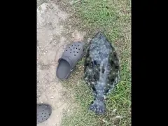
uploaded by: Flounder pounder

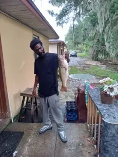
uploaded by: Stephen Spencer

uploaded by: Jon “Kuse”

uploaded by: Elzen Harris

uploaded by: RAMason69

uploaded by: Steven Butcheck

uploaded by: Joey Piercefield

uploaded by: Hoza

uploaded by: John Matthews
Best Fishing Spots in the greater Dade City area
Beaches and Bays are ideal places for land-based fishing. If the beach is shallow and the water is clear then twilight times are usually the best times, especially when they coincide with a major or minor fishing time. Often the points on either side of a beach are the best spots. Or if the beach is large then look for irregularities in the breaking waves, indicating sandbanks and holes. We found 2 beaches and bays in this area.
Larkin Camp Lake - 5km , Bayou Lake - 11km
We found a total of 97 potential fishing spots nearby Dade City. Below you can find them organized on a map. Points, Headlands, Reefs, Islands, Channels, etc can all be productive fishing spots. As these are user submitted spots, there might be some errors in the exact location. You also need to cross check local fishing regulations. Some of the spots might be in or around marine reserves or other locations that cannot be fished. If you click on a location marker it will bring up some details and a quick link to google search, satellite maps and fishing times. Tip: Click/Tap on a new area to load more fishing spots.
Hester Lake - 2km , Tank Lake - 2km , Boiler Lake - 3km , Ferguson Lake - 3km , Hamilton Lake - 3km , Indian Lake - 3km , Lake Linda - 3km , Sumner Lake - 3km , Suwannee Lake - 3km , Tobe Lake - 3km , Jordan Lake - 4km , Knee Deep Lake - 4km , Moss Lake - 4km , Sanbar Lake - 4km , Sandbar Lake - 4km , Duck Lake - 5km , Horseshoe Lake - 5km , Ivy Stag Lake - 5km , Larkin Camp Lake - 5km , Larkin Lake - 5km , O'Berry Lake - 5km , Ray Pond - 5km , Wynn Lake - 5km , Blanton Lake - 6km , Lake Gilbert - 6km , Harrison Lake - 6km , Hudson Lake - 6km , Lake Pasadena - 6km , Point Lake - 6km , Seaboard Pond - 6km , Buddy Lake - 7km , Clear Lake - 7km , Dollar Pond - 7km , Dobes Hole - 8km , Hidden Lake - 8km , Karney Lake - 8km , Sand Pond - 8km , Dowling Lake - 9km , Mirror Lake - 9km , Bird Lake - 10km , Jessamine Lake - 10km , Long Pond - 10km , Bayou Lake - 11km , Block Pond - 11km , Bonnet Lake - 11km , Bonnett Pond - 11km , Croft Pond - 11km , Flag Pond - 11km , Lake Iola - 11km , McClendon Lake - 11km , Moody Lake - 11km , Pretty Pond - 11km , Tucker Lake - 11km , Brown Bridge - 12km , Mud Lake - 12km , Sawgrass Lake - 12km , Dick Lake - 13km , King Lake - 13km , Middle Lake - 13km , Robison Lake - 13km , Sixteen Section Pond - 13km , Saint Clair Lake - 14km , Sea Pond - 14km , Weaver Hole Slough - 14km , Lake Bernadette - 15km , Charlotte Pond - 15km , Lake Elizabeth - 15km , Lake Francis - 15km , Lake Geneva - 15km , Hancock Lake - 15km , Nicks Lake - 15km , Patsy Pond - 15km , Simmon Pond - 15km , Lake Zephyr - 15km , Zuke Pond - 15km , Mills Smokehouse Pond - 16km , Sixmile Pond - 16km , Bird Island Lakes - 17km , Cow Ford Bridge - 17km , Cypress Lake - 17km , Halfway Pond - 17km , Mountain Lake - 17km , Seaburg Hammock - 17km , Spring Lake - 17km , Trial Ford Bridge - 17km , Coon Prairie Pond - 18km , Cross Creek Bridge - 18km , Griswold Pond - 18km , Neff Lake - 18km , Raulerson Hammock - 18km , Redden Prairie Pond - 18km , Stanley Fish Hole - 18km , Thomas Lake - 18km , Blanket Grass Pond - 19km , Boat Pond - 19km , Oakes Pond - 19km , Gold Lake - 20km
Comments